
Map and globe
The map inside Network Monitor: pins, arcs, 2D and 3D styles, where this Mac is, why some destinations have no place, and the location database.
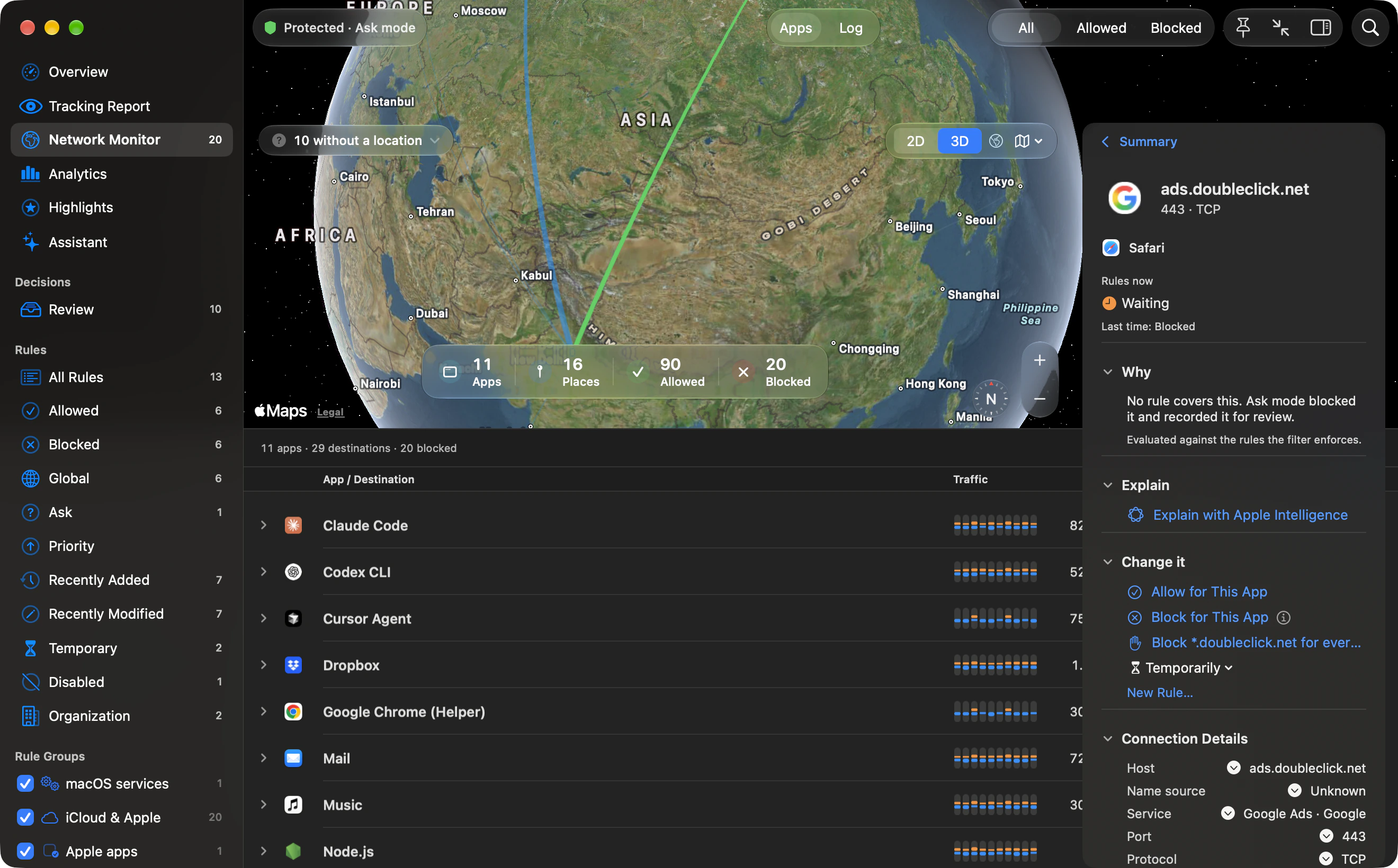
The map lives inside the Network Monitor. Show it with the map button or View › Show Map (⌥⌘M). It starts on, and it starts in 3D. Arcs run from this Mac to destinations Outbound could place.
Pins and arcs
Section titled “Pins and arcs”A pin’s colour follows how fresh the traffic is, and a denied destination uses the blocked colour (red). Live traffic, active in the last 15 seconds, is green. The last five minutes use the download colour, blue in the default Orange and Blue pair, and older traffic is a quieter shade of that colour. Colours are regraded on a 15-second clock, so a busy map does not change colour every frame.
The map draws up to 100 places, and always includes the busiest place, the places of the app you have focused, and up to 40 extra places that are live right now.
This Mac is the accent colour inside a soft ring.
Controls
Section titled “Controls”- View: 2D or 3D. 3D’s help is “Showing the Earth as a globe. Choose 2D for a flat map.” 2D’s help is “Showing a flat map. Choose 3D to see the Earth as a globe.”
- Map Style: Standard, Muted, Satellite or Dots. The menu is titled Map Style.
- A button that shows the whole Earth again. In 3D its help is “Show the whole globe”. In 2D it is “Show the whole world”. Dots has no such button, because that style already shows the whole world.

| Style | What the menu says in 2D | What the menu says in 3D |
|---|---|---|
| Standard | Land, water and borders, clearly drawn. | The globe from satellite imagery, with place names. 2D draws the map. |
| Muted | Softer colors, so your routes stand out. | The globe from satellite imagery, without labels. |
| Satellite | Photographic imagery. Uses more memory. | Photographic imagery. Uses more memory. |
| Dots | A drawn world without map tiles. Uses the least memory and graphics. | The same sentence. Dots is drawn by Outbound, not by the map tiles. |
In 3D, Standard and Satellite draw imagery with place names, and Muted draws imagery without labels. The stored style does not change when you switch 2D and 3D.
The compact window hides the 2D/3D switch, the style menu, the location chip, zoom and the compass.

Destinations without a location
Section titled “Destinations without a location”A chip counts them, “N without a location”. The list shows 60 at a time, with Show All for the rest. A long list grows a search field, prompt “Search destinations and apps”. That search matches words. It does not use the Network Monitor’s field syntax.
The list, titled Destinations without a location, groups them by why they have no place. Each group has a heading and one line of explanation:
| Group | Its explanation |
|---|---|
| Loopback | “Loopback addresses refer to this Mac.” |
| Local Network | “Private and link-local addresses stay on a local network.” |
| iCloud Private Relay | “This address is listed in Apple’s published iCloud Private Relay egress ranges.” |
| Not in Database | “The location database has no coordinates for this destination.” |
| No Location Database | “Install the location database in Settings › Monitor › Map.” |
The iCloud Private Relay ranges ship with Outbound, so this check does not go online either. When the location database is updated, the map uses the new data without a restart.
The list and the totals
Section titled “The list and the totals”The pane lists the apps that are talking and where. Tap a place and the list narrows to it. Tap again to clear. A strip under the map totals Apps, Places, Allowed, Blocked, Sent and Received.
Where this Mac is
Section titled “Where this Mac is”This Mac is the point the arcs start from. By default it is placed by the Mac’s time zone. There are three ways to change it:
- Right-click a spot on the map and choose Set This Mac’s Location Here. Use Time Zone in the same menu goes back to the time zone.
- In Settings › Monitor, choose a Location: System Time Zone, Determine Automatically, or one of the Mac’s time zones, shown by city. A spot you set on the map appears there by name.
- Choose Determine Automatically to let Location Services find this Mac. macOS asks for permission first. Settings says: “Location Services is optional. When used, only a location rounded to about 10 km is saved on this Mac and shared with its map widgets.”
Until a location is found, or when access is denied, the map uses the system time zone and Settings says so.
The location database
Section titled “The location database”Place names come from DB-IP City Lite. Outbound labels the download 60 MB. The attribution it shows is “IP Geolocation by DB-IP”, under CC BY 4.0. Lookups stay on this Mac.
While the main app is open, Outbound checks at launch and every six hours, if Update the location database automatically is on (it starts on). A missing database is downloaded unless you deleted it. An installed database is refreshed when its build date is missing or falls in a different UTC month. Deleting it stops that automatic return. Download on the Overview, or a manual install in Settings, clears that stop and fetches it again. A failed first download is tried again after two minutes, up to three times in that launch.